Wednesday, August 25, 2010

Some thoughts after getting thru the first 12...

It's not taken long for us to learn a few lessons and to figure out just how the 120 in 12 is going to go.  We started this journey on August 1 and have to be finished by July 31, 2011.  In twenty one days, we have seen twelve counties out of one hundred and twenty.  I'm glad we have gotten off on such a good start, because life is about to slow us down.  School has started, soccer has started and basketball isn't that far off.  Our time is really going to be limited and we won't be able to see counties in groups of four or five like we have been.  The problem is, we have to average 10 counties a month.  Thats 2.5 per week and with all that is going on till the end of the year, we will be lucky to average 2 per week.  If that ends up being the case, we will be way behind by the first of the year.  But never fear, we will persevere and get through them all!  The map above shows the counties we have visited so far.
I'm not sure our rules for this project have been completely laid out, I will list them here, so as you read our posts you will know why we may have done what we did.
  1. Put our feet on the ground in all 120 Kentucky Counties in 12 months time.
  2. We don't have to visit anything in particular, just visit the county.
  3. Take a few pictures to record our visit.
  4. Lastly, we have to learn something we did not know about the county.
Pretty simple rules.  The down side is, some counties will really be shorted because of the time factor and others will see a lot more of us because there is so much to do or we have had something recommened to us.

If you've been reading all of our posts, I have been listing some of the issues we have faced so far.  The biggest issue is time.  Although it's not one of the rules, we want to take the road less traveled and avoid the Interstates or major highways as much as possible.  This truly allows us to see the counties we are visiting.  Unfortunately, traveling takes a little longer on these roads.

The other issue I have notice is, the first county we visit on a multiple county day gets the longest visit.  By the time we reach our last county we are out of time and have stop, look around, take a picture and head home.  Hopefully we will get better at planning our trips and distribute our time more evenly.  This will be a neccesity with the limited time we are going to have over the next few months.  My guess is, we will be making some short nearby county trips in the evenings to help keep our average up.

The last "problem" is the amount of time it takes to research the background info on each county.  I have up to two hours of writing time in each post.  A few of them are under an hour but the average is probably about 90 minutes.  I have to figure out how to become a better researcher.

Those are about all the issues we have experienced.  And those issues pale in comparison to the time we have spent together and the things we have learned.  I would rank this as some of the best Family Time we have ever had.

Just a few thoughts on the counties we have visited so far.  I have traveled a lot more than mom and the boys, so I have been to several of the places we have visited and will visit.  But there are a few that I had not been to and some things that have stood out to me.

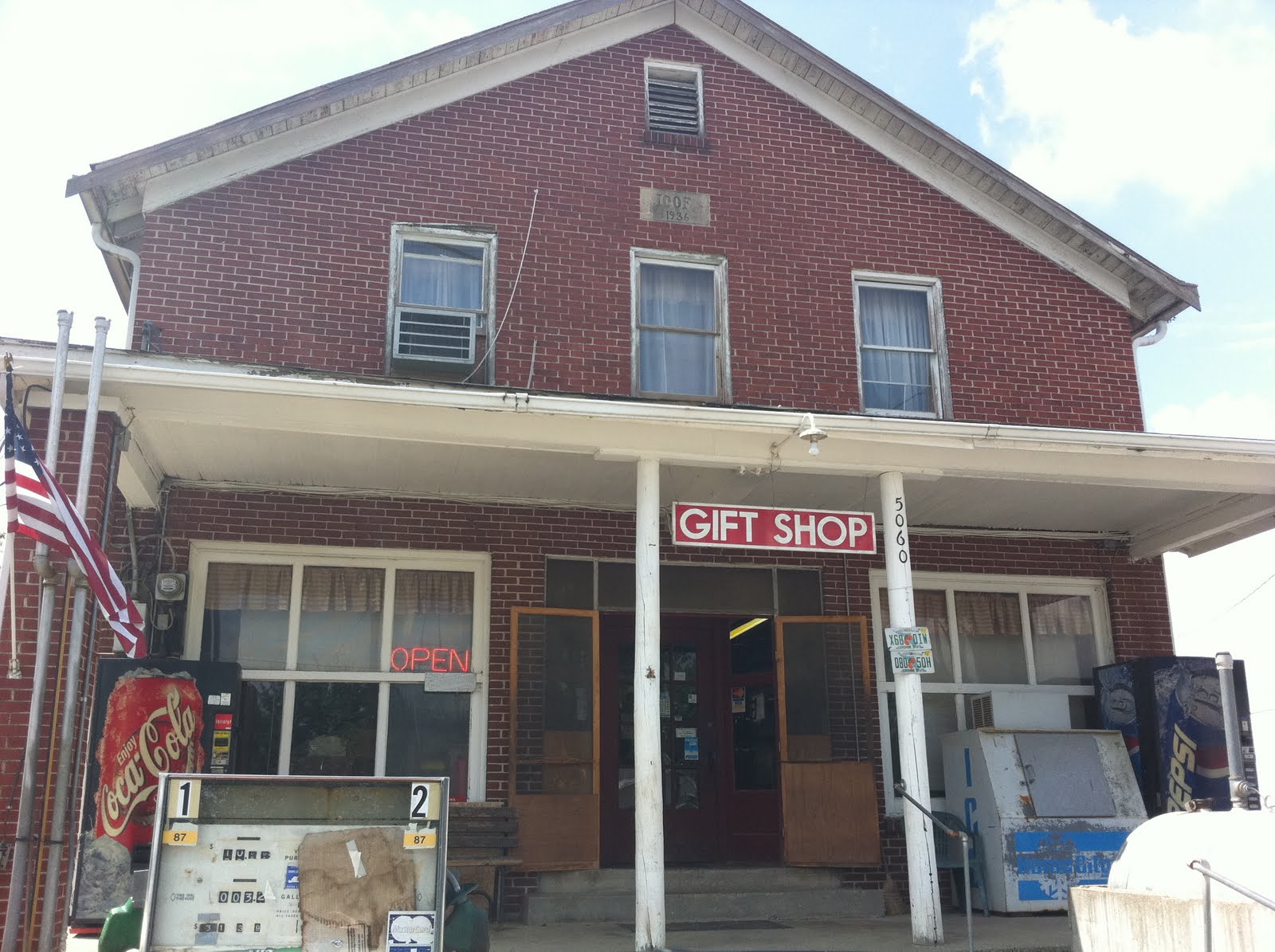
One of the first things that comes to mind is, I had no idea there was a Federal Prison in McCreary County.  I had never been to the University of the Cumberlands campus.  I have been to Bell County and the Cumberland Gap, but I did not know that Middlesboro was built entirely in a meterorite crater.  Like I mentioned in my Laurel County post, I had eaten at the original Kentucky Fried Chicken before, but didn't mind doing it again with the boys.  That place is rightfully a National Landmark.  KFC is a huge part of American pop culture.  Living in Central Kentucky I have heard of Bybee Pottery and have even owned a piece, but had never been there.  I never realized the long history that they have.  What can I say about Rabbit Hash?  We loved it there!  It's places like that we wished we had more time.  Then there was the Jackass Farm.  How do we ever beat that?

Don't take it as these are the only places we have liked.  In fact, we have enjoyed each and every stop.  You'll notice on the right side of the page an ever growing list of places we will return to when this is all over.  I'm afraid by the time this over, that list will be over 100 items long.  This project could go on for years!

I hope all of you are enjoying this as much as we are.  I encourage you to sign up and follow the 120 in 12.  The response we have gotten so far has been amazing.  Everyone wants to know where we've been and where we are headed next.  I can't speak for the rest of them, but I love talking about it.  If you have any suggestions on places to visit, places to avoid, places to eat or if you want to join us sometime, please let us know.  For those of you who don't know us, I'm sure you'll recognize Roadkill if you see him.  If you do, come on over and say hello.

See you on the road...

Tuesday, August 24, 2010

Grant County

We didn't have to go very far from our last stop to make it into Grant County.  All we had to do was walk cross the street.  We opted to drive about a half a mile down the road, but we were still in Jonesville, the Grant County side.

Like I've said before the early counties get the long visits and the late counties get the short ones.  I'll tell you all about it once we cover the background.

GRANT COUNTY BACKGROUND

Grant County was formed by an act of the Kentucky Legislature in February 1820 and was the sixty seventh county formed in the Commonwealth.  The county was named for two brothers John and Samuel Grant from North Carolina.  Today, the county seat is Williamstown which was established in 1822.  The town was originally 25 square miles laid out in one-quarter acre lots.  A fire destroyed almost all of the buildings on Main Street in 1856.  County Judge O.P. Morgan traveled Central Kentucky raising fund to rebuild the city. 

I have to stop for a second and confess that the research for the background/history of each county we visit takes quite a bit of time.  I have to sort through all the information, decide what should be included in my post and then put it together in a way that makes some sort of sense.  I have learned quite a bit of information by going through this process.  But when researching Grant County I found something that truly stood out.  In 1876 the United States Congress asked every town and county in the country to write their histories and read them aloud on July 4, 1876 as Centennial celebration.  First off, I had never heard of this so I was surprised when I found Grant County's published online.  If you have further interest in the history of Grant County I recommend you follow this link and read the account written by R.H. Elliston in 1876.

OUR VISIT

We left the Jonesville Store which is in Owen County drove a few blocks and stopped at the Jonesville Park which is in Grant County.  This made our "family" adventure complete for the day, since we had been to Rabbit Hash and Jonesville.

Of course Roadkill wasn't going to let us get out of there without visiting the Williamstown.  Luckily for him we had to go that direction to hit the Interstate.  So we jumped on Highway 38 and headed on into town.

Williamstown is laid out a little differently than most of the other towns we have visited so far.   The streets come into downtown at an angle.  It's a unique design.  The next thing I know we find ourselves at the courthouse.  We take a few minutes to look around and snap a few pictures.  As always, time was working against us, so it was time to head towards home.

We had a full day!  We had seen several unique site and learned a few bits of information that we didn't know.  On the way home we already started planning the next outing.  If all goes well, we will travel east next weekend.  See you on the road.

Monday, August 23, 2010

Owen County

After a filling lunch at Jewell's on Main in Gallitin County we headed down Highway 35 towards Owen County.  We only knew of one thing we wanted to see for sure when we got there but decided to head into Owenton too.  Part of the fun of this odyssey is driving and seeing where the car takes us next.  As soon as we cover the background, I'll tell you all about our visit.

OWEN COUNTY BACKGROUND

Owen County was formed in 1819 from portions of Scott County, Gallatin County and Franklin County.  The county was named for Colonel Abraham Owen.  Colonel Owen was a member of the Kentucky Legislature and was the first Kentuckian to serve under General William Henry Harrison.

Owen County was the 62nd county formed in Kentucky.  The county seat is the city of Owenton.  However the original county seat was the city of Hesler but was moved to Owenton in 1822.

During the Civil War, the county leaned toward the Confederacy and they operated two recruiting camp there.  Although many resident joined the cause, there were no organized battles fought there.

Elk Creek Vineyards is located in Owen County and is the largest winery in the Commonwealth.  Elk Creek was opened in 2003 and offers a deli, an art gallery, a gift shop, live entertainment and a B&B.

OUR VISIT

Like I said before we had only one thing on our list for Owen County and that was to visit Jonesville.  After looking at the map though, to get to the road that took us there, we were only going to be about 5 miles from Owenton, so why not stop?
So stop we did, after waiting for about 200 motorcycles to pull out in front of us on some sort of poker run.  After we got moving again, we went straight downtown and found the courthouse.  Roadkill always wants to see those for some reason.  Needless to say that is where we usually end up.  We didn't really do much else while we were there, other than check out the downtown.  Unfortunately we didn't have much time.  We really want to see Elk Creek Vineyard but the clock was ticking.  Looks like we have another gotta back item.

After we left Owenton, we wound our way out County Road 36 towards Jonesville.  It is a great scenic drive.  For a couple of mile the road run along a ridgetop and you can see for miles.  When we finally got to Jonesville, we stop at the little store to get something to drink.  We knew we were headed to Grant County next, so I ask the girl working in the store how close we were.  She said you'll be in Grant County as soon as you cross that yellow line in the road.  It turns out Jonesville is half in Owen County and half in Grant.  We spent a few minutes on the Owen County side then headed on into Grant County.  Follow me on over to the next page and I'll tell you all about it.

Gallatin County

Like I said in our last post, we got behind from the very start on this trip. I had no choice but to shift it into high gear and get us to Gallatin County.  We took US 42 out of Boone County, which is not the straightest road I've ever been on.  But we saw some great sites along the way. I guess I would have fit right in at the Kentucky Speedway, as fast as we got there.  Before I tell you all about it, we'll cover a little background.

GALLATIN COUNTY BACKGROUND

Gallatin County was established in 1798.  It was the Commonwealth's 31st county and was formed from parts of Franklin and Shelby Counties and is situated in northern Kentucky along the Ohio River.  Over the years, parts of Gallatin County were carved off to create three other counties, Owen County in 1819, Trimble County in 1836 and Carroll County in 1838.  After these reductions, Gallatin County today is only one tenth of its original size. Today, Warsaw is the county seat, it was originally founded as Fredericksburg.

During the early nineteenth century,  there was a brisk river trade route between Gallatin County and New Orleans.  Producers shipped numerous products from there, including soap, hemp, furs, produce and salt pork, to name a few.  Although there are large sand and limestone deposits in the area, agriculture remained the primary economic resource.  As late as 1987, over 80% of land in the county was used for agricultural purposes.

Gallatin County was also a hotbed of activity during the Civil War.  There were several skirmishes within its borders.  It has been reported that in September of 1864 George M. Jesse and his Confederate troops controlled Gallatin as well as a few other Kentucky Counties.

In December of 1868 one of the worst steamboat accidents in history happened near Warsaw.  Two separate passenger steamers, The America and the United States collided in the middle of the night.  The America rammed the United States setting the kerosene it was carrying on fire.  Flames consumed both boats and spread over the surface of the river.  One hundred sixty two people lost their lives in this tragedy as well as over $350,000 worth of property.

As time moved on, river trade began to decrease and the age of the riverboat was gone.  Today though, Interstate 71 runs through Gallatin County, connecting Cincinnati and Louisville. 

In 1956 the Army Corps of Engineers began construction on the Markland Lock and Dam, that connects Gallatin County with Switzerland County in Indiana.  The dam was placed in operation in 1959 and was completely finished in 1964.  Today, Duke Energy operates an 81,000 kVA electric generating facility at the dam.

One of the biggest draws to Gallatin County has to be the Kentucky Speedway.  It is located just off of I-71 in Sparta.  The track opened in 2000 and will finally host a NASCAR Sprint Cup Race in July of 2011.  As of today, construction has begun to expand the facility and add 50,000 more seats.

OUR VISIT

The first stop on our visit to Gallatin County was the Kentucky Speedway.  As luck would have it and like several other stops on the 120 in 12, the track was closed and we could only see from the road.  We did however drive around the perimeter to get a good look at the facilities.  With the announcement of the NASCAR race next year, the construction work has already started. 
Because we were running behind, we were going to let that be our only stop in Gallatin County, but gawking at the racetrack and stopping to take pictures every few hundred yards, we made a wrong turn.  So we headed on into Warsaw, and man are we glad we did.  It is a quaint little town of just over 1,800 people.


We headed straight downtown and parked.  I got out to take a picture of the Courthouse, when this guy came up to me, laughed and said, you know all pictures are $5.  We had a good laugh and I asked him if there was any where good to eat nearby.  It was lunchtime after all.  He said there sure is, it's right behind you, and they should open in about 5 minutes.  So we walked around downtown and took a few more pictures, while we waited for Jewell's on Main to open.

Jewell's on Main was your typical small town diner/restaurant stepped up a level or two.  I guess you could call it more of a casual dining restaurant.  I had the catfish, mom had the chicken salad and z had chicken strips.  None of us had any complaints.  It was just good old home cooking.  Mom and z also shared an order of fried green tomatoes.  The decor was very simple but otherwise appealing.  If I have one complaint, it would be that we weren't greeted real warmly.  We were obviously "strangers" in town, by the looks we were getting.  I was hoping the owner would come out and introduce himself, but he never did.  Other than that I would give the place two thumbs up.  If you ever find yourself in Warsaw, Kentucky I would recommend stopping by Jewell's on Main for lunch or dinner.

After taking an hour for lunch, we were really running out of time fast!  I had every intention of getting us to a total of 12 counties by the end of the day if it killed us.  So, we scooted out of town down Hwy 35 towards Owenton in Owen County.  Stick around and we'll see you there.

Sunday, August 22, 2010

Boone County

What a day we had on Saturday!  We got started a little later than we had planned, but had a great time nonetheless.  No one seemed to want to get out of bed on time except for mom.  Then, when we got out of the house we realized we had left Roadkill at home, so we had to go back and get him.  Good thing too, he had a good time this weekend as well.  He was jumping in pictures everywhere we stopped.  Our first stop was in Boone County.  I can't wait to tell you about it, but first we have to cover the history.

BOONE COUNTY HISTORY

Boone County was established in 1799 after the Kentucky Legislature approved its forming in 1798.  At that time less than 200 men owned all the land in the county.  The county is located in the largest bend in the Ohio River and has over 42 miles of waterfront along the Ohio to the north and west.  Historically, Boone County's economy has been driven by agriculture with such crops as tobacco, soybeans, corn and livestock.  However, with the construction of the airport in the late '40s and I-75 in the late '60s, Boone County has seen the addition of other industries.  The county was named for frontiersman Daniel Boone and the county seat is Burlington.  There are several other well known cities located throughout the county, including Florence, Hebron, Union and Walton.

Boone County is known to be home to several prehistoric sites dating back to 1150 A.D.  The first European likely to have visited the area was a Frenchman who sailed down the Ohio River in 1729.  The area of the map that is now Boone County has an inscription that says "where they found the bones of an elephant".  This eventually led to further exploration of the area that is now Big Bone Lick.  Big Bone Lick is an ancient swamp that had a combination of water and minerals that large prehistoric animals could not resist.  Bones of mammoths, bison, mastodons, stag-moose and giant sloths have been found there.  The specimens that have been obtained from this area are world renowned.

The Cincinnati/Northern Kentucky International Airport is located in Hebron and is the 5th largest Delta Airlines hub in the country.  The airport was completed and saw its first landing in January of 1947, an American Airlines DC-3.  The airport has 4 runways the largest of which is 12,000 feet long.  The airport sees over 247,000 flights annually.  Comair, a division of Delta is based at this airport.

The Florence Mall was opened in 1976.  It is a two-story facility that has seen several renovations over the years.  It currently has 130 tenants and is the largest mall in Northern Kentucky.  The mall is located just off of Interstate 75 and is known for the water tower on the front of the property that says "FLORENCE Y'ALL".

One of the more colorful areas of Boone County is Rabbit Hash.  There are several versions on where the name Rabbit Hash came from.  In one version the name is based on a local legend that says the town was well-known on the Ohio as having great rabbit hash and was often visited by river travelers.  The legend continues that in 1831 a pirate ship docked and entered the town and killed all the residents and burned all the buildings.  The next steamboat to stop for hash saw a 3 foot sign that said Rabbit Hash on the only building left standing, so they thought it was the name of the town.  Since the town is currently unincorporated, the exact boundaries are unknown.  Because of the this, the population is estimated between 4 and 40.  Its also fun to note, the residents elected a dog as mayor in 1998.  They have even made a movie about it, Rabbit Hash: The Center of the Universe.

OUR VISIT

The first place we visited was the Cincinnati/Northern Kentucky International Airport.  We have been there several times but we thought it would be a good place to start and work our way back towards home.  Since I have flown out of there a few times, we decided to visit the airplane viewing area off of Donaldson Road.  We set there and watched the planes land for a few minutes and took a few pictures as well.  There is a Historical Marker there that says the Center of the US population was in that spot in 1880.  The population at that time was over 49.3 million.

We knew we wanted to go to Rabbit Hash, since moms maiden name is Hash.  So when we left the airport we headed back through Florence towards Rabbit Hash.  We had to go back into town, because one of the boys needed some allergy medicine.  So we had to stop by Wal-Mart.  I  haven't mentioned it before, but this is not the first Wal-Mart stop on the 120 in 12.  I think that mom and the boys have another plan on top of the 120 in 12.  I think they are trying to see every Wal-Mart in the state as well.  Anyway, on our way, we passed Turfway Park.  One of the boys asked what it was, so we told them it was a racehorse track and decided to stopped for a picture.  Of course Roadkill had to jump right in it.  Then as we were trying to get out of town, z sees a factory where they make Airheads and mentos.  Naturally he wanted a picture of that too.  So we went back and snapped a quick one.

From there, we jumped on Highway 18 and got off on Lower River Road and followed the Ohio River for several miles, until we reached Rabbit Hash.  The turn off is marked with a sign denoting its listing on the National Historic Register.  We loved this place as soon as we rounded the corner.  It's a collection of maybe a half a dozen buildings, including the Rabbit Hash General Store, The Old Hashienda, an antique store and a few other buildings.   We visited the General Store and spent half an hour looking around and talking with who I assume was the owner, Teri.  We talked about the store and she told the boys a few secrets and we told her about our 120 in 12 adventure.  She loved it and asked if she could have her picture taken with Roadkill.  Of course, we obliged.  This is one of the places we decided we needed a souvenir from, so we picked a few things. We spent a few more minutes looking around "town" and taking a few more pictures.  They even had a his and hers public outhouse.  We could have stayed there all day, but the road was calling and we had at least 3 more counties to see.

We left Rabbit Hash going up Rabbit Hash Hill Road.  We hadn't driven very far, when I saw a sign and surprised at what it said.  I thought there is no way there is really such a place.  I thought I might wreck from laughing.  So we turned around and went back.  Sure enough, it said exactly what I thought it did.  If we hadn't had any photo opportunities up to this point, we had one now!  I'm of the opinion this might be one of the most unique things we will see on the 120 in 12.  Yes, that's right, it is a Jackass Farm.

As we were headed out of Boone County towards Gallatin County, we happened to drive by Big Bone Lick State Park.  Mom and I had visited there several years ago for a cookout with friends, but the boys had never been, so again we made a quick stop.  We were there just long enough for Roadkill to get his picture taken again.

I've already started to see another pattern emerging.  The County that is the first one on the list for the day gets the longest visit.  We had planned on the airport and Rabbit Hash, but ended up with four other stops.  Now we were really running behind.  Good thing we were on our way to The Kentucky Speedway, because I was flying!

The first 12...


This is the first of 10 different videos from our travels.  I hope to post a video after every 12 counties we visit.

Friday, August 20, 2010

Madison County

The last stop on our venture, this time out was Madison County.  There is sooo much to do there, but our time was getting short and the kids were getting tired and ready to be at home.  You could spend days seeing the sites, but we only had a couple of hours, so we made the best of it.  We also had the same problem in Madison County, that we had in Rockcastle.  No way to stop on the interestate to get a photo of the county sign.  We will pick one of these up though, when we visit Clark County.  But now it's time for a little Madison County background.

MADISON COUNTY BACKGROUND

In 1779 a group of settlers petetioned the Virginia legislature to build a settlement at Boonesborough.  Soon after, a warehouse was built.  In 1785, Madison County became the seventh county formed in the Commonwealth.  It was named in honor of the Constitutional Convention member and Virginia stateman, James Madison, who eventually became President of The United States.  The city of Richmond was formed in 1798 and became the county seat.

Madison County has several well know cities and towns, including Richmond, Berea, Paint Lick and Bybee.  Richmond is home to Eastern Kenucky University and Berea is home to Berea College.

In 1906, the Kentucky General Assembly approved a Bill to establish a Normal School in eastern and western Kentucky.  Richmond civic leaders sponsered a successful campaign to have the Eastern University located there.  It was to be located on the the site of the Walters Collegiate Institute formerly the grounds of Central University.  Today Eastern is home to over 15,000 students and 2,700 faculty and offers numerous degress in in 27 different programs.

Berea College was founded in 1855 as an interracial and coeducational college in the south.  Berea is unique in that they do charge tuition. All student work a minimum of 10 hours per week in campus and service jobs.  The college has an inclusice Christian character which is expressed in its motto "God has made of one blood all peoples of the Earth".  Berea offers Bachelor of Arts and Science degrees in 28 fields.

The community of Bybee was founded in 1809 by a group of potters, interested in the clay that was naturally occuring there. 

OUR VISIT

Let me start of by saying, that we did not visit Boonesborough State Park while we were in Madison County.  It is located on the Clark / Madison County line.  This is one of the few occasions we will probably back track a little when we visit Clark County.  It is one one those places that is tied so deeply in Kentucky history and close to home, that the boys have to visit.

The first stop on our visit was to the city of Berea.  Berea is best known for its local craftsmen and is considered as the Arts and Crafts Capital of Kentucky.  It has also recently been named to the list of the Top 25 Arts destinations in the nation, by AmericanStyle Magazine.  You can't throw a rock and not hit some sort of craft or artisan store.  It's one of those unique places, not only in Kentucky but throughout the country.

Our first stop was at the Berea Welcome Center and Tourism Office.  There, we met the nicest two ladies.  I spent most of my time talking with them while mom and the boys spent time looking at their exhibits.  One of the things that mom said she wanted to do on the trip to Madison County was to visit the world famous Bybee Pottery.  In talking with our new friends at the Tourism Office, we had just over an hour before the pottery shop closed, and we were almost 45 minutes away.  That meant we were not going to get to visit the Berea College campus.  I have vsited there numerous time, but the boys have never seen it, so that is something else added to the "when we go back" list.

Needless to say we scooted on out and headed towards Bybee.  I must drive a little faster than the two older ladies we met in Berea, I made the trip in just over 30 minutes, and that was after taking a wrong turn.  The good news is we made it.  I didn't really know what to expect, but was surprised when we got there.  The business is housed in a log cabin that they have been in for over a century.  Bybee is the oldest pottery west of the Alleghenies.  This is another one of those stories that I could not do justice too, so I recommend you visit their website and find out for yourself.

Of course we couldn't visit without buying a piece or two.  I really didn't like the first one she picked, but we finally agreed on 2 pieces that we both liked.  Surprisingly it wasn't as expensive as you might have thought.  That's the other cool thing about the 120 in 12, the souveniers we are collecting!

So, that was the end of our journey for this go 'round.  After visiting Bybee, we headed on home.  Our next day trip is scheduled for 08/21/10, this time, we'll be headed north.  We hope to hit at least four counties that day and may try to squeeze in a fifth.  If we can hit at least four though, we will be 1/10 of the way through, which has us ahead of schedule!  I hope you are enjoying reading as much as we are living it.  See you next week...

Rockcastle County

Then next stop on our journey was Rockcastle County, home of the world famous Renfro Valley.  We crossed the county line both in and out, on the interstate, so we were unable to get a picture of the green highway sign.  It made me realize we have to do a little better planning from here on out, so that we can get a picture.  But we we found the sign pictured at the left, downtown Mount Vernon.  As usual, we will cover a little background on Rockcastle County.

ROCKCASTLE COUNTY BACKGROUND

The county seat is Mount Vernon, and is named for George Washington's home.  The area was originally settled around 1790 and was a stop on the Wilderness Road by 1792.  The surrounding area was originally swampland. 

The county was formed in 1810 from portion of Lincoln, Madison, Knox and Pulaski counties.  Rockcastle was the fifty-second county formed in Kentucky.  The county shares its name with the Rockcastle River which was named by explorer Isaac Lindsey in 1767.  The name comes from the large cliffs along the river the Lindsey described as castles.  Almost one fourth of the county lies within the Daniel Boone National Forest.  The county has seen its population grow by almost 50% since 1970.

The extraction of saltpetre from the Great Saltpetre Cave was one of the first industries in the county.  Saltpetre is used to make gunpowder.  The cave also served as shelter for both Union and Confederate troops during the Civil War.

Rockcastle County is also home to Renfro Valley.  It is the site of the "Renfro Valley Barn Dance" national radio program.  This show was started in 1939 by John Lair.  Refro Valley still hosts several shows a week, ranging from local Bluegrass talent to major country music recording stars.

OUR VISIT

Our visit to Rockcastle County was unfortunately pretty quick.  We jumped off of I-75 and headed into Mount Vernon, the county seat.  We parked on Main Street and took a few minutes to check out downtown.  The more of these towns we visit, the more I enjoy the "small town" atmosphere.  There wasn't much going on, so we head on out to Renfro Valley.

We were expecting to see a crowd out there, but being a monday afternoon, nothing was open.  We were the only ones there, except for a few workers.  But we were able to get a few pictures and we can say we have been there.  None of us are really country or bluegrass music fans, but it's one of those things, that speaks to our Kentucky heritage.  Renfro Valley is the home to the Kentucky Music Hall of Fame and Museum, and as luck would have it, they were closed on Mondays.

It was a short trip, but a good trip.  My guess is, we will head back that way to see a show at Renfro Valley, like I said, it's just part of who we are as Kentuckians.

Tuesday, August 10, 2010

Knox County

Heading North on US 25 out of Bell County, our next stop was Knox County.  It was about this time that we came to realize something.  And that is, there are a lot of colleges in Kentucky.  We were on our way to see another one.  This time it was Union.  However, you should know the drill by now, first a little background on Knox County.

KNOX COUNTY BACKGROUND

Knox County was formed in December of 1799, having been seperated from what was then called Lincoln County.  Originally, all of the upper Cumberland Valley was included in Knox County.  However, over the years several other counties were formed in this area.  It was the 41st county formed in Kentucky.  The county's namesake is General Henry Knox of Massachusetts, America's first Secretary of War.

The county seat is Barbourville and the only other city is Corbin.  Corbin is unique in that it straddles 3 counties; Knox, Whitley and Laurel.

Daniel Boone helped blaze The Wilderness Trail through Knox County.  It is also said that the first log cabin in Kentucky was built in Knox County by Dr. Thomas Walker while exploring in the interest of the Royal Land Company in 1750.  There is an exclusive spot just outside of Flat Lick, where three historic roads converge to become one road heading to The Cumberland Gap.  They are Boone's Trace, The Wilderness Road and The Warrior's Path

During the nineteenth century, Barbourville was the largest city south of Richmond and was a major stop for settlers and travelrs who crossed the Cumberland Gap.

The first Kentucky Civil War Battle took place in Barborville as Confederate forces destroyed a Federal recruiting station on what is now Union College's campus.  This Battle saw the deaths of soldiers on both sides of the conflict.

Union College was formed in 1879 and is affiliated with the United Methodist Church and offers 27 degrees in the liberal arts.  It's campus encompasses 100 acres and 20 buildings near downtown Barbourville. 

OUR VISIT

After stopping on the highway to get a picture of Roadkill and the Knox County sign,  we headed over to the Union campus.  This is another extraordinary college campus in southeast Kentucky.  Unlike the University of the Cumberlands, the Union campus is covered in huge old elm trees and mountain laurel and has a more "plantation" type feel.  I know I'm starting to sound like a broken record, but no students were on campus here either.  However, there were a few people around because they parked everywhere nearly blocking the main entrance.

When we finished our quick look around campus, we moved a few streets over to downtown Barbourville.  We took a couple of minutes to snap a picture or two and decided to move on.  We had three more counties on the agenda and it was already lunch time.

My final thought on Knox County is this: They are extremely proud of their pioneer heritage.  It's evident in everything that you see.  It's good to see a community embrace their history and share it with all who visit.

Bell County


We were on the road and traveling towards Bell County by 9:00 am Monday morning.  We headed east out of Williamsburg (Whitley County) on Hwy 92.  We decided to spend the last day of our vacation trying to hit as many counties as we could.  So, we opted to start in Bell County, run north on US 25, catch I-75 in Corbin and head north towards home from there.  There is a TON to do in Bell County, but first a touch of history:

BELL COUNTY BACKGROUND

Bell County was formed in August of 1867 from parts of Harlan and Knox Counties.  The county is named after Joshua Frye Bell a former Congressman and Kentucky Secretary of State.  Pineville is the county seat, but Middlesboro is the largest city in the county with a population just over 13,000. 

Large amounts of county records were destroyed in fires in 1914 and 1918.  Again, more records were destroyed in 1977 during a flood.  Pineville is located on the Cumberland River were it passes by Pine Mountain.  Middlesboro is located just on the Kentucky side of the Cumberland Gap.

Middlesboro has a claim to fame that no other city can claim.  It is built completely in a meteorite crater.  The other unique bit about Middlesboro is, it does not have a Main Street.  It's equivilent is Cumberland Avenue.

As with most of the counties in the area, early industries included coal and timber. 

The Cumberland Gap was first discovered by Dr. Thomas Walker in 1750.  The Gap had long been used by Native Americans and was widened by a group of loggers led by none other than Daniel Boone.  It is estimated that between 200,000 - 300,000 immigrants passed through the gap before 1810.

The Cumberland Gap Tunnel was complete in 1996 under the gap, at which time, the original trail was restored.  The Gap was added to the National Historic Register on May 28, 1980.

Bell County is also home to Pine Mountain State Resort Park.  Pine Mountain has the distinction of being named Kentucky's first state park in 1924.  Originally named Cumberland State Park, it's name was changed in 1938, so it wouldn't be confused with nearby Cumberland Falls.

As you leave US 25 headed towards Pine Mountain, you pass by Clear Creek Bible College.  Clear Creek was founded in 1926 by Dr. Lloyd Caswell Kelly, pastor of the First Baptist Church in Pineville.  Clear Creek's objective is to provide theological preperation for adults called of God to Christian Service.

OUR VISIT

We bypassed everything and headed straight for The Cumberland Gap Tunnel.  We drove through the Tunnel into Tennessee and immediately turned around and came straight back.  Once we were back in Kentucky, we stopped at the Cumberland Gap National Historical Park.  While we were there, we spent some time looking around the Visitor's Center and gathering information for the rest of our Monday excursion.  Browsing through some of the local informational pamphlets, that we learned that the City of Middlesboro is built completely inside a meteorite crater.  Once the 120 in 12 is finished and time allows, we will plan to revisit the Park to hike some of the over 80 miles of trails they have mapped.

After we left the Park, we stopped off in Middlesboro at the Bell County Historical Society Museum.  When we walked in the door, we were welcomed  by the most pleasant man with a strange accent.  He told us his name was David Thompson and that he was originally from Russia.  We explained to him our 120 in 12 project and that we didn't have much time, but we were interested in the fact that Middlesboro was built inside a crater.  He was so helpful and accomodating, showing us the information we were looking for.  We thoroughly enjoyed talking with him and could have stayed and chatted all day, but time was ticking by.  He had such a wide range of knowledge that went beyond the call of the Bell County Museum.  If you ever get the chance, we highly recommend stopping in.

Jumping back on US 25 North, we were on our way to Pine Mountain.  Once we made the turn and were headed towards the park, we realized we would be going by Clear Creek Bible College.  We couldn't wait to stop since we have a friend who graduated from there.  But, just like every other college we've been to the last two weeks, it's summer break.  So there wasn't anyone around except for a few administrative and maintenance people.  We got out, took a few pictures and moved on.  If you look real close, that's Roadkill sitting on top of the wall.

Driving just around the bend and up the mountain, the next thing we knew, we were at Pine Mountain State Resort Park.  Knowing we were short on time, hiking the trails were not going to be an option today, so we drove on up to the lodge, looked around, took a few pictures and moved on.  But the facilities looked extremely nice.  They were completely remodeled in 1999.  On the corner of US 25 is the Wasioto Winds Golf Course.  Wasioto was ranked as the 4th Best New Affordable Golf Course in 2004, by Golf Digest.

We wrapped up our tour of Bell County, by driving through Pineville.  Pineville seems to be a great little mountain town.  It reminds me of other communities in the area I have visited in the past.

Time was against us and we had over a hundred miles to cover and four more counties to see, before the day was over.  We stayed on US 25 North and were on our way to Knox County.  See you there!