Showing posts with label State Parks. Show all posts

Tuesday, September 28, 2010

Boyle County

We had no intention of visiting Boyle County on this outing.  But like I mentioned in my last post, we HAD to visit Nevada and Texas on this trip.  All it takes is a quick look at a map and it's not hard to figure out, that if you're in Nevada and want to go to Texas, you have to go through Perryville.  We knew we didn't have the time go to Danville, but Perryville would make a good stop for us, so we decided to check it out.

BOYLE COUNTY BACKGROUND

Boyle County was formed in 1842 from parts of Lincoln and Mercer counties.  It was the ninety-fourth county formed in Kentucky.  The county seat is Danville.  The county is named for John Boyle a prominent Chief Justice of the Kentucky Court of Appeals, Congressman, and U.S. District Judge. 

Danville is considered "The City of Firsts" for being the first in many different areas.  Some of these are, it was the location of the first courthouse in Kentucky, had the first U.S. Post Office west of the Alleghenies, home to the first college in the west and was also the first Capital of Kentucky.

Boyle County / Danville is also home to Centre College.  Centre was founded by Presbyterian leaders and was officially charted by the Commonwealth in January of 1819.  The school gets its name from being located in the geographical center of Kentucky.  Centre boasts a literal Who's Who in America among its alumni.  Today they offer 27 majors on a 152 acre campus containing 66 building, 14 of which are on the National Historical Register.  Please visit this page for a complete look at the history of Centre College.

Perryville is the site of the largest Civil War battle in Kentucky.  It has also been described as one of the bloodiest battles in modern times.  The Union suffered 4,421 casualties with a force of 22,000  -  28,000 men.  They were as follows: 845 killed, 2,851 wounded and 515 captured or missing.  The Confederacy employed 16,000 troops, of which there were casualties of 3,396.  Those losses were as follows: 510 killed, 2,635 wounded and 251 captured or missing.  Writing a brief narrative of something so monumental to American and Kentucky history is next to impossible.  I encourage you to visit the official webpage of the battle.  You can find it at http://www.battleofperryville.com/ .

OUR VISIT

We anticipated a short visit to Boyle County on our way to Texas.  A quick stop at the Perryville Battlefield and then move on down the road.  I was vaguely familiar with the Battle of Perryville, but didn't know many details.  Before we went to the battlefield we stopped in town, because I saw one of the painted wall advertisements that I like so much.   After a quick stop there, we made our way towards the battlefield.  It was a lot further outside of town than I expected. 

The entrance to the park is impressively unimposing.  From the entrance, you would have no idea you were about to visit a place that saw the death of over 1,300 men.  Once you find yourself inside the park, it is hard to imagine that such a horrible tragedy happened in a place as beautiful as this.  It is a prime example of the rolling hills of the bluegrass.  The park offers memorials to both the United States and Confederate soldiers who died or were wounded that day.  Just like in my last post, I would not be doing the memories of these fine men of both sides any justice if I did not show you pictures of the memorials.

 We ended up spending a lot more time there than we had anticipated.  We found ourselves reading and studying all of the markers around the park.  When you're standing there it is hard to even conceive a battle the size of the one that took place there.  On top of all the men that were killed there that day in early October, 1862, almost 5,500 men were wounded.  The devastation was so great and the losses so big, the Confederacy never returned to Kentucky in great force again.  With this battle the state stayed firmly in the Union.


Time was running short and we had two more counties to see.  So we loaded up jumped on U.S. 150 for the quick ride to Texas on our way to Springfield in Washington County.

Sunday, August 22, 2010

Boone County

What a day we had on Saturday!  We got started a little later than we had planned, but had a great time nonetheless.  No one seemed to want to get out of bed on time except for mom.  Then, when we got out of the house we realized we had left Roadkill at home, so we had to go back and get him.  Good thing too, he had a good time this weekend as well.  He was jumping in pictures everywhere we stopped.  Our first stop was in Boone County.  I can't wait to tell you about it, but first we have to cover the history.

BOONE COUNTY HISTORY

Boone County was established in 1799 after the Kentucky Legislature approved its forming in 1798.  At that time less than 200 men owned all the land in the county.  The county is located in the largest bend in the Ohio River and has over 42 miles of waterfront along the Ohio to the north and west.  Historically, Boone County's economy has been driven by agriculture with such crops as tobacco, soybeans, corn and livestock.  However, with the construction of the airport in the late '40s and I-75 in the late '60s, Boone County has seen the addition of other industries.  The county was named for frontiersman Daniel Boone and the county seat is Burlington.  There are several other well known cities located throughout the county, including Florence, Hebron, Union and Walton.

Boone County is known to be home to several prehistoric sites dating back to 1150 A.D.  The first European likely to have visited the area was a Frenchman who sailed down the Ohio River in 1729.  The area of the map that is now Boone County has an inscription that says "where they found the bones of an elephant".  This eventually led to further exploration of the area that is now Big Bone Lick.  Big Bone Lick is an ancient swamp that had a combination of water and minerals that large prehistoric animals could not resist.  Bones of mammoths, bison, mastodons, stag-moose and giant sloths have been found there.  The specimens that have been obtained from this area are world renowned.

The Cincinnati/Northern Kentucky International Airport is located in Hebron and is the 5th largest Delta Airlines hub in the country.  The airport was completed and saw its first landing in January of 1947, an American Airlines DC-3.  The airport has 4 runways the largest of which is 12,000 feet long.  The airport sees over 247,000 flights annually.  Comair, a division of Delta is based at this airport.

The Florence Mall was opened in 1976.  It is a two-story facility that has seen several renovations over the years.  It currently has 130 tenants and is the largest mall in Northern Kentucky.  The mall is located just off of Interstate 75 and is known for the water tower on the front of the property that says "FLORENCE Y'ALL".

One of the more colorful areas of Boone County is Rabbit Hash.  There are several versions on where the name Rabbit Hash came from.  In one version the name is based on a local legend that says the town was well-known on the Ohio as having great rabbit hash and was often visited by river travelers.  The legend continues that in 1831 a pirate ship docked and entered the town and killed all the residents and burned all the buildings.  The next steamboat to stop for hash saw a 3 foot sign that said Rabbit Hash on the only building left standing, so they thought it was the name of the town.  Since the town is currently unincorporated, the exact boundaries are unknown.  Because of the this, the population is estimated between 4 and 40.  Its also fun to note, the residents elected a dog as mayor in 1998.  They have even made a movie about it, Rabbit Hash: The Center of the Universe.

OUR VISIT

The first place we visited was the Cincinnati/Northern Kentucky International Airport.  We have been there several times but we thought it would be a good place to start and work our way back towards home.  Since I have flown out of there a few times, we decided to visit the airplane viewing area off of Donaldson Road.  We set there and watched the planes land for a few minutes and took a few pictures as well.  There is a Historical Marker there that says the Center of the US population was in that spot in 1880.  The population at that time was over 49.3 million.

We knew we wanted to go to Rabbit Hash, since moms maiden name is Hash.  So when we left the airport we headed back through Florence towards Rabbit Hash.  We had to go back into town, because one of the boys needed some allergy medicine.  So we had to stop by Wal-Mart.  I  haven't mentioned it before, but this is not the first Wal-Mart stop on the 120 in 12.  I think that mom and the boys have another plan on top of the 120 in 12.  I think they are trying to see every Wal-Mart in the state as well.  Anyway, on our way, we passed Turfway Park.  One of the boys asked what it was, so we told them it was a racehorse track and decided to stopped for a picture.  Of course Roadkill had to jump right in it.  Then as we were trying to get out of town, z sees a factory where they make Airheads and mentos.  Naturally he wanted a picture of that too.  So we went back and snapped a quick one.

From there, we jumped on Highway 18 and got off on Lower River Road and followed the Ohio River for several miles, until we reached Rabbit Hash.  The turn off is marked with a sign denoting its listing on the National Historic Register.  We loved this place as soon as we rounded the corner.  It's a collection of maybe a half a dozen buildings, including the Rabbit Hash General Store, The Old Hashienda, an antique store and a few other buildings.   We visited the General Store and spent half an hour looking around and talking with who I assume was the owner, Teri.  We talked about the store and she told the boys a few secrets and we told her about our 120 in 12 adventure.  She loved it and asked if she could have her picture taken with Roadkill.  Of course, we obliged.  This is one of the places we decided we needed a souvenir from, so we picked a few things. We spent a few more minutes looking around "town" and taking a few more pictures.  They even had a his and hers public outhouse.  We could have stayed there all day, but the road was calling and we had at least 3 more counties to see.

We left Rabbit Hash going up Rabbit Hash Hill Road.  We hadn't driven very far, when I saw a sign and surprised at what it said.  I thought there is no way there is really such a place.  I thought I might wreck from laughing.  So we turned around and went back.  Sure enough, it said exactly what I thought it did.  If we hadn't had any photo opportunities up to this point, we had one now!  I'm of the opinion this might be one of the most unique things we will see on the 120 in 12.  Yes, that's right, it is a Jackass Farm.

As we were headed out of Boone County towards Gallatin County, we happened to drive by Big Bone Lick State Park.  Mom and I had visited there several years ago for a cookout with friends, but the boys had never been, so again we made a quick stop.  We were there just long enough for Roadkill to get his picture taken again.

I've already started to see another pattern emerging.  The County that is the first one on the list for the day gets the longest visit.  We had planned on the airport and Rabbit Hash, but ended up with four other stops.  Now we were really running behind.  Good thing we were on our way to The Kentucky Speedway, because I was flying!

Tuesday, August 10, 2010

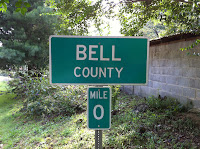
Bell County


We were on the road and traveling towards Bell County by 9:00 am Monday morning.  We headed east out of Williamsburg (Whitley County) on Hwy 92.  We decided to spend the last day of our vacation trying to hit as many counties as we could.  So, we opted to start in Bell County, run north on US 25, catch I-75 in Corbin and head north towards home from there.  There is a TON to do in Bell County, but first a touch of history:

BELL COUNTY BACKGROUND

Bell County was formed in August of 1867 from parts of Harlan and Knox Counties.  The county is named after Joshua Frye Bell a former Congressman and Kentucky Secretary of State.  Pineville is the county seat, but Middlesboro is the largest city in the county with a population just over 13,000. 

Large amounts of county records were destroyed in fires in 1914 and 1918.  Again, more records were destroyed in 1977 during a flood.  Pineville is located on the Cumberland River were it passes by Pine Mountain.  Middlesboro is located just on the Kentucky side of the Cumberland Gap.

Middlesboro has a claim to fame that no other city can claim.  It is built completely in a meteorite crater.  The other unique bit about Middlesboro is, it does not have a Main Street.  It's equivilent is Cumberland Avenue.

As with most of the counties in the area, early industries included coal and timber. 

The Cumberland Gap was first discovered by Dr. Thomas Walker in 1750.  The Gap had long been used by Native Americans and was widened by a group of loggers led by none other than Daniel Boone.  It is estimated that between 200,000 - 300,000 immigrants passed through the gap before 1810.

The Cumberland Gap Tunnel was complete in 1996 under the gap, at which time, the original trail was restored.  The Gap was added to the National Historic Register on May 28, 1980.

Bell County is also home to Pine Mountain State Resort Park.  Pine Mountain has the distinction of being named Kentucky's first state park in 1924.  Originally named Cumberland State Park, it's name was changed in 1938, so it wouldn't be confused with nearby Cumberland Falls.

As you leave US 25 headed towards Pine Mountain, you pass by Clear Creek Bible College.  Clear Creek was founded in 1926 by Dr. Lloyd Caswell Kelly, pastor of the First Baptist Church in Pineville.  Clear Creek's objective is to provide theological preperation for adults called of God to Christian Service.

OUR VISIT

We bypassed everything and headed straight for The Cumberland Gap Tunnel.  We drove through the Tunnel into Tennessee and immediately turned around and came straight back.  Once we were back in Kentucky, we stopped at the Cumberland Gap National Historical Park.  While we were there, we spent some time looking around the Visitor's Center and gathering information for the rest of our Monday excursion.  Browsing through some of the local informational pamphlets, that we learned that the City of Middlesboro is built completely inside a meteorite crater.  Once the 120 in 12 is finished and time allows, we will plan to revisit the Park to hike some of the over 80 miles of trails they have mapped.

After we left the Park, we stopped off in Middlesboro at the Bell County Historical Society Museum.  When we walked in the door, we were welcomed  by the most pleasant man with a strange accent.  He told us his name was David Thompson and that he was originally from Russia.  We explained to him our 120 in 12 project and that we didn't have much time, but we were interested in the fact that Middlesboro was built inside a crater.  He was so helpful and accomodating, showing us the information we were looking for.  We thoroughly enjoyed talking with him and could have stayed and chatted all day, but time was ticking by.  He had such a wide range of knowledge that went beyond the call of the Bell County Museum.  If you ever get the chance, we highly recommend stopping in.

Jumping back on US 25 North, we were on our way to Pine Mountain.  Once we made the turn and were headed towards the park, we realized we would be going by Clear Creek Bible College.  We couldn't wait to stop since we have a friend who graduated from there.  But, just like every other college we've been to the last two weeks, it's summer break.  So there wasn't anyone around except for a few administrative and maintenance people.  We got out, took a few pictures and moved on.  If you look real close, that's Roadkill sitting on top of the wall.

Driving just around the bend and up the mountain, the next thing we knew, we were at Pine Mountain State Resort Park.  Knowing we were short on time, hiking the trails were not going to be an option today, so we drove on up to the lodge, looked around, took a few pictures and moved on.  But the facilities looked extremely nice.  They were completely remodeled in 1999.  On the corner of US 25 is the Wasioto Winds Golf Course.  Wasioto was ranked as the 4th Best New Affordable Golf Course in 2004, by Golf Digest.

We wrapped up our tour of Bell County, by driving through Pineville.  Pineville seems to be a great little mountain town.  It reminds me of other communities in the area I have visited in the past.

Time was against us and we had over a hundred miles to cover and four more counties to see, before the day was over.  We stayed on US 25 North and were on our way to Knox County.  See you there!

Sunday, August 1, 2010

What z thinks

I want to see all the things Kentucky has to offer and all the fascinating things that we have never seen. For example I hope to see things like Cumberland Falls, Mammoth Cave and all the State Parks. I love to take pictures, I will be taking pictures of everywhere we go. I will probably share some of them here.

I'm glad I get to do this with my family. I'm also glad I get to do this because I think it will be good experiences that I can remember for a long time. I think this is something that I will eventually be able to tell my kids about. I hope this will lead us to be able to travel to other states more and see all the things they have to offer and maybe even to other countries.